当前位置:
首页»科学研究» 科研动态
【12.22讲座】A Time Series Approach to Urbanization Induced Land Use and Land Cover Changes and Impact on Land Surface Temperature
发布时间:Sun Dec 20 15:50:00 CST 2015
Time: 2015年12月22日(周二)上午10:00-12:00
Address: 北京师范大学京师科技大厦(南院)B座520
Qihao Weng, Indiana State University, USA
Abstract:
The growth of free medium resolution satellite imagery (such as Landsat data archive), adding to the data pool of previously available coarse resolution satellite imagery, has created a new research opportunity in remote sensing. Some key research questions arise, such as: (1) how can consistent information be extracted from satellite imagery to monitor urban growth and to form a long-term climatology? And (2) how can urbanization associated land use and land cover changes affect the intra- and inter-annual temperature trend? This lecture introduces to our approach to time series image analysis, through case studies of mega-cities and conurbations in the USA and China, to examine the impact of urban growth on land surface temperature.
Biography:

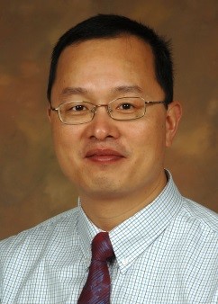
Dr. Qihao Weng is the Director of the Center for Urban and Environmental Change and a Professor of geography at Indiana State University, USA. Currently serving as an Editor-in-Chief of ISPRS Journal of Photogrammetry and Remote Sensing, he was a visiting Senior Fellow at NASA Marshall Space Flight Center (2008-09). Dr. Weng received a Ph.D. degree in geography from the University of Georgia in 1999. Since 2001, he has been a member of the faculty in the Department of Earth and Environmental Systems at Indiana State, where he has taught courses on remote sensing, digital image processing, GIS and environmental modeling, and has mentored more than two dozens of graduate students. Dr. Weng’s research focuses on remote sensing analysis of urban ecological and environmental systems, land-use and land-cover change, environmental modeling, urbanization impacts, and human-environment interactions. He is the author of over 175 publications and 9 books, with citations of 8000 and H-index of 41. Dr. Weng has worked extensively with optical and thermal remote sensing data, and more recently with LiDAR data, with financial support from US funding agencies that include NSF, NASA, ESA, USGS, USAID, NOAA, National Geographic Society, and Indiana Dept of Natural Resources. Dr. Weng was the recipient the 2011 Outstanding Contributions Award in Remote Sensing and the 2015 Willard and Ruby S. Miller Award for his outstanding contributions to geography, both from American Association of Geographers (AAG), and the 2010 Erdas Award for Best Scientific Paper in Remote Sensing by American Society for Photogrammetry & Remote Sensing (1st place). At Indiana State, he received the Theodore Dreiser Distinguished Research Award in 2006 and was selected as a Lilly Foundation Faculty Fellow. In May 2008, he received a prestigious NASA senior fellowship. Dr. Weng has given 88 invited talks, including keynote addresses, public speeches, colloquia, and seminars. Dr. Weng is the Coordinator for GEO’s Global Urban Observation and Information Task (2012-15), and the Series Editor of Taylor & Francis Series in Remote Sensing Applications.
相关附件:
